Tampilkan postingan dengan label Svalbard. Tampilkan semua postingan

Rabu, 28 Januari 2015

Rain Storms Devastate Arctic Ice And Glaciers

by Veli Albert Kallio


The Norwegian Svalbard Islands are located just few hundred miles from the North Pole. It is a unique environment for glaciers: Here glaciers can survive almost at sea level. This means that ice is constantly brushed by thick low-altitude air, which also dumps increasinlgy rain instead of snow.

As a result of high ocean temperatures and of precipitation nowadays falling as rain for months, the melting of these glaciers now occurs 25 times faster than just some years ago.

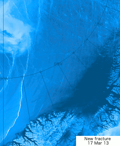
This also spells bad news for Northern Greenland's low lying glaciers, which will face increasing summertime flash floods as the Arctic Ocean becomes ice free and warms up, and as precipitation falls in the form of rain, rather than snow.

Sea surface temperature of 17.5°C, west of Svalbard
click on image to enlarge
Last summer, for example, sea water west of the Svalbard reached +18C, which is perfect for swimming - but extremely bad for the cold glaciers on shore which mop up the warm moisture and rainfall from the warmed up ocean.

Flash floods falling on glacier soften the compacted snow very rapidly to honeycombed ice that is exceedingly watery and without any internal strength.

Such ice can collapse simply under its own weight and the pulverised watery ice in the basin forms a near frictionless layer of debris.

Darkening of the melting ice also hastens its warming and melting.

Aggressively honeycombed glacier ice floating on meltwater lake in nearby Iceland.   Image credit: Runólfur Hauksson


click on image to enlarge

Changes to the Jet Streams

As the Arctic continues to warm, the temperature difference between the equator and the Arctic declines. This slows down the speed at which the polar vortex and jet streams circumnavigate the globe and results in more wavier jet streams that can enter and even cross the Arctic Ocean and can also descend deep down over the continents, rather than staying between 50 and 60 degrees latitude, where the polar jet streams used to be (as discussed in a recent post).

Such deep descent over continents can cause very low temperatures on land, while at the same time oceans remain warm and are getting warmer, so the temperature difference between land and ocean increases, speeding up the winds between continents. On January 9, 2015, jet streams reached speeds between continents as high as 410 km/h (255 mps), as shown on above image. Also note the jet stream crossing the Arctic Ocean.

Faster winds means more water evaporation, and warmer air holds more water vapor, so this can result in huge rainstorms that can rapidly devastate the integrity of the ice.

[image and text in yellow panels by Sam Carana]


I suspect that climatically-speaking we are currently entering a methane-driven Bøllinger warming state with the Northern Cryosphere now entering a phase of rapid warming and melting of anything frozen (snow, sea ice, permafrost and sea bed methane clathrates).

This will be rapidly followed by a Heindrich Iceberg Calving event when the warmed and wet ice sheet in Greenland gives away to its increased weight (due to excessive melt water accumulation within and beneath the ice sheet).

This dislodges the ice sheet’s top, due to accumulation of “rotten ice” (honeycombed, soft ice with zero internal strength) at the ice sheet’s base and perimeters.

A huge melt water pulse to the ocean ensues with Jōkullhaups and ice debris loading the ocean with vast amounts of cold fresh water.

Within weeks an immense climatological reversal then occurs as the ocean gets loaded up with ice debris and cold water leading to the Last Dryas cooling and to world-wide droughts.

This loading of the ocean with ice and water leads to severe climatic flop, as the ocean and atmosphere cool rapidly and as falling salinity and sea water temperature briefly reverse all of the current Bøllinger warming, until the climatic forcing of the greenhouse gases again takes over the process, in turn leading to a new melt water pulse as another ice sheet or shelf disintegrates by the next warming.

Today’s rapid melt water lake formation in Greenland and the ultra-fast melting of glaciers are suggestive of near imminent deglaciation process in the Arctic.

Germany’s and Japan’s recent decisions to remove all their nuclear reactors from the sea sides may prove their worth sooner than many think in the far more conservative US and UK where “glacial speed” still means “eons of time”. Good luck UK/US!

I think cold 'Dryases' are not real Ice Ages, but hiatuses in a progressive melting process which results from changes in sea water salinity and temperature due to increases of meltwater and ice debris runoff from continental snow and ice that melt. As ocean gets less saline and colder the sea ice and snow cover temporarily grows.

But in the long run the greenhouse gas forcing and ocean wins and the warmth and melting resumes until the next big collapse of ice shelf and/or ice sheet. Hence there are meltwater pulses (such as 1a, 1b, 1c) and Heindrich Ice Berg Calving surges (2, 1, 0 - the last one being also called "Younger Dryas" as the Arctic Dryas octopetala grew in South once again after Ice Ages).

The next cooling from collapse of Greenland ice dome would be Heindrich Minus One as the zero has already been allocated to Younger Dryas ice berg surge. Here is an article worth reading on this risk. In Antarctica we see currently (already) a sea ice growth hiatus driven by increased runoff of melt water and ice debris from the continent and its surrounding ice shelves that are rapidly disintegrating.


Abrupt climate change happened in just one year

A 2008 study by Achim Brauer et al. of lake sediments concluded that abrupt increase in storminess during the autumn to spring seasons, occurring from one year to the next at 12,679 yr BP. This caused abrupt change in the North Atlantic westerlies towards a stronger and more zonal jet, leading to deglaciation.

A 2009 study by Jostein Bakke et al. confirmed that increased flux of fresh meltwater to the ocean repeatedly resulted in the formation of more extensive sea ice that pushed the jet south once more, thus re-establishing the stadial state. Rapid oscillations took place until the system finally switched to the interglacial state at the onset of the Holocene.

References

- An abrupt wind shift in western Europe at the onset of the Younger Dryas cold period, Brauer et al.
http://www.nature.com/ngeo/journal/v1/n8/abs/ngeo263.html

- Rapid oceanic and atmospheric changes during the Younger Dryas cold period, Bakke et al.
http://www.nature.com/ngeo/journal/v2/n3/abs/ngeo439.html


Kamis, 26 Desember 2013

Sea Ice in decline between Svalbard and Greenland

[ click on image to enlarge ]
Above image shows that Earth's highest atmospheric methane concentrations are recorded over the Arctic Ocean. The insets show lower methane concentrations over various continents, North and South America (top left), Europe (mid right), Australia bottom left) and Antarctica (bottom right).

The top right inset shows sea ice thickness, illustrating that methane is escaping from the sea floor of the Arctic Ocean and is transported by currents to the thinner edges of the sea ice, where it is entering the atmosphere.

As discussed in a recent post, methane can be bubbling up in the Arctic Ocean with a force strong enough to prevent sea ice from forming in the area. This feedback is depicted in the Diagram of Doom further below as feedback #13.


Around this time of year, Arctic sea ice is typically growing rapidly, both in extent and thickness.

However, the above image shows that in the area marked by the white circle, between Svalbard and Greenland, the sea ice is actually in decline.

[ click on image to enlarge ]
This decline is caused by methane that is entering the atmosphere in the area as warmer water continues to be transported by the Gulf Stream into the Arctic Ocean, as discussed in previous posts such as this one, and as also illustrated by the image on the right.

Warmer than average waters have been entering the Arctic Ocean along the Gulf Stream since July 2013, when changes to the Jet Stream contributed to waters off the North American coast reaching record warmest temperatures, as depicted in the Diagram of Doom below as feedback #11.

In summary, the above images show that methane makes it hard for ice to form, while the warm water of the West Spitzbergen Current is pushing the ice away, breaking up even the thickest ice to the north of Greenland.

Surface temperatures in the area have been extremely high recently. This part of the Arctic Ocean was hit by an 18+°C anomaly during the week from December 16 to December 22, 2013, as illustrated by the image below.


On some days that week, anomalies of 20+°C were recorded over an even larger part of the Arctic Ocean, as described in a previous post. These anomalies show how a number of feedbacks can interact and contribute to huge warming peaks in the Arctic Ocean, such as methane releases (feedbacks #2 and #13 in the diagram below) and changes to the Jet Stream (feedbacks #10 and #11 in the diagram below).

This spells bad news for the sea ice. Some people may have hoped that the thicker sea ice north of Greenland would take decades to disappear. However, as depicted in the Diagram of Doom below, feedbacks can hugely accelerate sea ice decline. As sea ice declines further, more open water make it more likely that stronger storms and cyclones will appear that can rip the sea ice apart and move the pieces into the Atlantic Ocean in a matter of days.

The image below, by Jim Pettit, illustrates the ongoing decline of the sea ice.


Thirteen feedbacks that can accelerate warming in the Arctic are depicted in the diagram below.


Specific feedbacks are described in the following posts:
- Diagram of Doom
- Further feedbacks of sea ice decline in the Arctic
- Causes of high methane levels over Arctic Ocean
- Methane Release caused by Earthquakes
- How Do We Act in the Face of Climate Chaos?
- The astounding global warming impact on our oceans . . .
- Methane emerges from warmer areas
Feedbacks are pictured in a more general way in the image below.


Above image shows how the accumulation of the many feedbacks and their interaction leads to ever stronger albedo changes, while the resulting accelerated warming in the Arctic causes increasing quantities of methane to be released from the seafloor of the Arctic Ocean, in turn leading to runaway global warming, as also pictured in the image below.

[ click on image to enlarge ]
As above image shows, a polynomial trendline already points at global temperature anomalies of 5°C by 2060. Even worse, a polynomial trendline for the Arctic shows temperature anomalies of 4°C by 2020, 7°C by 2030 and 11°C by 2040, threatening to cause major feedbacks to kick in, including albedo changes and methane releases that will trigger runaway global warming that looks set to eventually catch up with accelerated warming in the Arctic and result in global temperature anomalies of 20°C+ by 2050.

To reduce these risks, comprehensive and effective action is needed, such as described at the Climate Plan blog.

Rabu, 30 Oktober 2013

Greenland Sea hit by M5.3 Earthquake

An earthquake with a magnitude of 5.3 on the Richter scale hit the Greenland Sea near Svalbard on October 28, 2013.

[ Earthquake indicated by orange dot - click on image to enlarge ]

For a long time, huge sea surface temperature anomalies have shown up in the area where the earthquake hit. The image below compares the situation before and after the earthquake hit.

[ click on image to enlarge ]

These huge sea surface temperature anomalies were discussed before, in the September 19, 2013, post Is the North Pole now ice-free?

This post mentions that sea surface temperatures in some spots close to Svalbard are far higher than even in the waters closer to the Atlantic Ocean. In some of these spots, sea surface temperatures are well over 10°C (50°F).

The post continues: Where does this heat come from? These hot spots could be caused by undersea volcanic activity; this is the more dangerous as this area has seen methane bubbling up from destabilized hydrates before; the dangers of this situation have been discussed repeatedly, e.g. in the April 2011 post Runaway Global Warming.

Indeed, the big danger is large abrupt release of methane from destabilized hydrates. At the moment, the amount of methane entering the atmosphere over the Arctic Ocean is already huge, as illustrated by the image below that shows high methane readings over the past few days.

[ click on image to enlarge ]

We'll keep monitoring the situation.

Sabtu, 21 September 2013

High Methane Readings over Arctic Ocean

The image below shows a lot of methane over the Arctic Ocean on September 19, 2013 (pm).


Very worrying are the high methane readings close to Gakkel Ridge, the divergent fault line at the center of the Arctic Ocean, as earlier discussed in the post Methane Release caused by Earthquakes.

Furthermore very worrying are the high methane readings in between Greenland and Novaya Zemlya that coincide with high sea surface temperatures in that area. As discussed in the earlier post Is the North Pole no ice-free?, there are hot spots in the Arctic Ocean where sea surface temperatures are well over 10°C (50°F), which could be caused by undersea volcanic activity; this is the more dangerous as the area has seen methane bubbling up from destabilized hydrates.

For reference, images are added below of sea surface temperatures (top) and sea surface temperature anomalies (underneath) for September 19, 2013, showing sea surface temperatures recorded close to Svalbard that are far higher than even in the waters closer to the Atlantic Ocean.


Also for reference, highest mean and peak methane readings up to September 19, 2013, are added below.


Senin, 18 Maret 2013

Huge patches of warm air over the Arctic

Over the past month or so, huge patches with temperature anomalies of over 20 degrees Celsius have been forming over the Arctic.

The three images below show such patches stretch out from Svalbard to Novaya Zemlya (top), north of Eastern Siberia (middle) and over West Greenland and Baffin Bay (bottom).


How these patches with warm air developed is further illustrated by the animation below, which goes from February 12, 2013, to March 18, 2013.


This is a 2.3 MB file that may take some time to fully load. 

Paul Beckwith, regular contributor to the Arctic-news blog, comments:
Paul Beckwith,
B.Eng, M.Sc. (Physics),
Ph.D. student (Climatology)
and Part-time Professor,
University of Ottawa
 

"The problem with this type of pattern is that there is a tendency for what is termed the AD (Arctic Dipole) consisting of exceptionally high pressures over Northern Canada to Greenland. When the air leaves this region heading for the low pressure regions (winds) it curves to the right (due to Coriolis force) and is thus driven from the Bering Strait region to the North Pole and then out Fram Strait, this conduit is like flushing the toilet on the ice. Warm water is pulled to the cold North Pole and the ice is driven out the Fram Strait into the warm Atlantic where it is melted."

"But the really big problem is that this high pressure area over Northern Canada is a ridge (blocking) that stays pretty stationary over the summers and is directly causing the heat waves and drought in the western US (2003, 2011, 2012). Another really big problem is that the part of the ridge over Greenland (or large GBI = Greenland Blocking Index); as discussed by Overland, Francis, et. al. in 2012 causes excessive melt in Greenland (as we saw in July, 2012 when 97% of Greenland was melting on the surface instead of the usual 40%). This is sending the Greenland albedo into a steep drop, causing even more heat absorption and melting."

To illustrate this further, Paul adds the animation below, from weather.unisys.com.

This animation is a 1 MB file that may take some time to fully load
Paul adds: "The Greenland high could reach 1070 mb in next few days; that will bring huge temperatures! By comparison, the world record highest was 1085 in Mongolia in December 19, 2001".

The 1070 mb high over Greenland is further illustrated by the image below, from weather.unisys.com.


Indeed, as the jet stream slows down and becomes more wavier, such patches of warm air can be expected to extend more regularly into the Arctic. The result can be a huge melt of Arctic sea ice, as well as a huge melt of snow cover in Greenland, which also dramatically lowers albedo, as occurred in 2012 and as discussed in the earlier post Greenland is melting at incredible rate.

This spells bad news for the Arctic sea ice, which may well disappear altogether this summer.

Paul further adds: "For the record; I do not think that any sea ice will survive this summer. An event unprecedented in human history is today, this very moment, transpiring in the Arctic Ocean. The cracks in the sea ice that I reported on my Sierra Club Canada blog and elsewhere over the last several days have spread and at this moment the entire sea ice sheet (or about 99% of it) covering the Arctic Ocean is on the move. Clockwise. The ice is thin, and slushy, and breaking apart."

"This is abrupt climate change in real-time. Humans have benefitted greatly from a stable climate for the last 11,000 years or roughly 400 generations. Not any more. We now face an angry climate. One that we have poked in the eye with our fossil fuel stick and awakened. And now we must deal with the consequences. We must set aside our differences and prepare for what we can no longer avoid. And that is massive disruption to our civilizations."

The animation below, from genomewiki.ucsc.edu shows cracks in the sea ice with the Wikipedia image underneath showing the location.


Related posts

- Polar jet stream appears hugely deformed
- Hurricane Sandy moving inland

Kamis, 18 Oktober 2012

Methane hydrates: a volatile time bomb in the Arctic

By Carlos Duarte, University of Western Australia
and Antonio Delgado Huertas, Spanish Scientific Research Council CSIC

Methane locked under the Arctic ice could take climate change to a whole new level. Antonio Delgado Huertas
The risk with climate change is not with the direct effect of humans on the greenhouse capacity of Earth’s atmosphere. The major risk is that the relatively modest human perturbation will unleash much greater forces. The likelihood of this risk is intimately tied to the developments over the next decade in the Arctic.

Accelerating ice loss and warming of the Arctic is disturbing evidence that dangerous climate change is already with us. As I have argued earlier, now that we have realised this our efforts should be directed at managing the situation in the Arctic and avoiding the spread of dangerous climate change elsewhere.

The Arctic is a core component of the earth system. Six of the 14 climate change tipping points of the earth system are located in the Arctic region.

Whereas the term tipping point was initially introduced to the climate change debate in a metaphoric manner, it has since been formalised and introduced in the context of systems exhibiting rapid, climate-driven change, such as the Arctic. Tipping points have been defined in the context of earth system science as the critical point in forcing at which the future state of the system is qualitatively altered.

Tipping elements are defined, accordingly, as the structural components of the system directly responsible for triggering abrupt changes once a tipping point is passed. This is because they can be switched into a qualitatively different state by small perturbations.

Of the many tipping elements in the Arctic, that with potentially greatest consequences if perturbed is the vast methane deposit. Methane is a greenhouse gas. A molecule of methane has 20 times the greenhouse effect of a CO₂ molecule, and the release of methane has been linked to climatic transitions along the history of planet Earth.

The Arctic contains vast reserves of methane stored as methane hydrate, a gel-like substance formed by methane molecules trapped in frozen water. The methane hydrate deposits are estimated at between 1,000 and 10,000 Gigatons (109 tons) of CO₂-equivalents as methane, much of which is present in the shallow sediments of the extensive Arctic shelves. This amount of greenhouse gas is several times the total CO₂ release since the industrial revolution.

Even moderate (a few degrees C) warming of the overlying waters may change the state of methane from hydrates to methane gas, which would be released to the atmosphere. If this release is gradual, methane will add a greenhouse effect to the atmosphere. This will only be temporary, as it will be oxidised to CO₂, with a decline in the greenhouse effect of 20-fold per unit carbon.

However, if the state shift is abrupt it may lead to a massive release of methane to the atmosphere, which could cause a climatic jump several-fold greater than the accumulated effect of anthropogenic activity.
Data collected on a recent cruise confirm methane is being emitted. Antonio Delgado Huertas
Recent assessments have found bubbling of methane on the Siberian shelf. Models suggest that global warming of 3°C could release between 35 and 94 Gt C of methane, which could add up to an additional 0.5°C of global warming. Moreover, frozen soils and sediments contain large amounts of methane hydrates that can be released to the atmosphere. Indeed, rapid thawing of the Arctic permaforst has been reported to lead to the release of large amounts of methane.

In our most recent cruise this summer (June 2012) along the Fram Strait and Svalbard Islands we found concentrations of methane in the atmosphere of about 1.65 ppm. However our equilibrium experiments (air atmospheric with Arctic surface water) reached values that were generally between 2.5 ppm and 10 ppm, with maximum values up to 35 ppm. These results confirm that this area of the planet is emitting large amounts of methane into the atmosphere.

Understanding and forecasting the response of Arctic methane hydrate deposits to rapid warming and thawing in the Arctic is of the utmost importance.

Provided the magnitude of these risks, and those associated with other tipping elements in the Arctic, our collective response to climate change appears to be a careless walk on the razor edge.

Carlos Duarte receives funding from the Spanish Ministry of Economy and Competitiveness and the EU R&D 7th Framework Program to conduct research in the Arctic. He is affiliated, through a joint appointment, with the Spanish National Research Council (CSIC).

Antonio Delgado Huertas receives funding from Ministry of Economy and Competitiveness (Spain).
The Conversation

This article was originally published at The Conversation.
Read the original article.

Editor's note: For a discussion of the potency of methane compared to carbon dioxide, see the post Methane in the Arctic.

Sabtu, 11 Februari 2012

Methane venting in the Arctic


Above chart, based on historic NASA land-surface air temperature anomaly data (see interactive map at the bottom of this page), shows that the average temperature anomaly rise in the Arctic (latitude 64 and higher) looks set to reach 10°C within decades. 

These anomalies are based on annual averages that are also averaged over a huge area. The NASA image on the left shows temperature anomalies of over 10°C for the month December 2011.  

More detailed analysis shows that, over December 2011, the highest average temperature anomaly (12.8933°C) was recorded in the Kara Sea (latitudes 79 - 81 and longitudes 73 - 89).

NOAA daily data show even more prominent anomalies, especially for the area from the Kara Sea over Franz Josef Land to Svalbard (see Wikipedia image left). 

NOAA temperature anomalies for January 31, 2012, seem typical for the over 20°C anomalies that this area has experienced over the period December 7, 2011, to February 11, 2012. 

An animated image with the full data over the period December 7, 2011, to February 11, 2012, is displayed in an earlier post at this blog, temperature anomalies over 20 degrees Celsius. (Note: this is a 4.7MB file that may take some time to fully load.) 


How is it possible for this specific area to show such huge temperature anomalies? 

1. Rivers?

Could it be that warm water from rivers flows into the Kara Sea and is transferred to the atmosphere in this area? This seems unlikely, given that it is winter, while the mainland does not appear to be suffering similar temperature anomalies. The NOAA map below with anomalies for water temperatures (at surface level) also shows no particular anomalies for the Kara Sea.


2. Warm water from the Atlantic Ocean?

Above image shows that the water surface temperature anomalies are most prominent just north of Scandinavia. The reason for this is that thermohaline circulation is pushing warm water from the Atlantic Ocean into the Arctic Ocean, as evident when looking at actual water temperatures (image below). 


As above image shows, warm water from the Atlantic Ocean hasn't (yet) penetrated the Kara Sea, which makes sense in winter. Therefore, this also seems an unlikely candidate to explain the over 20°C air surface temperature anomalies in the area stretching from the Kara Sea over Franz Josef Land to Svalbard. 

3. Methane? 

A third possibility is that methane is venting from hydrates in the Arctic and is spread by the wind around the Arctic. This would explain the record methane level of 1870+ reached in the Arctic for January 2012, as shown on the image below. 

Particularly worrying is that this methane continues to rise. In the past, methane concentrations have fluctuated up and down in line with the seasons. Over the past seven months, however, methane has shown steady growth in the Arctic. Such a long continuous period of growth is unprecedented, the more so as it takes place in winter, when vegetation growth and algae bloom is minimal. The most obvious explanation for both the temperature anomalies in the Arctic and above image is that the methane is venting from hydrates in the Arctic.

See animation of methane levels July 2011 - January 2012 

Temperature anomalies over 20 degrees Celsius

The area of the Kara Sea, Franz Josef Land and Svalbard shows temperature anomalies of over 20 degrees Celsius. How can such anomalies be explained?  

Above animation is a 4.7MB file. It may take some time for the animation to fully load. It covers the period December 7, 2011, to February 11, 2012.

Continue reading at: Methane venting in the Arctic