Tampilkan postingan dengan label thickness. Tampilkan semua postingan

Jumat, 02 Januari 2015

Strong winds threaten to push sea ice out of Arctic Ocean

By Albert Kallio


The lateral viscosity of the thin Arctic sea ice cover continues to lower. In November just one quarter of the high Arctic Ocean basin above 85° north was covered by a thin this winter's ice. This has now doubled, soon covering two quarters. The ice has been pushed away from Russia towards Canada and to the Fram Strait at phenomenal rates.
 
Animation by navy.mil showing 30 days of sea ice thickness, up to January 1, 2015
This is increasingly suggesting that the remaining half in front of the Fram Strait will be sucked into the Atlantic Ocean soon. The dark blue ice is newly formed crushed ice behind the North Pole (pack ice). We may well be in course to the first recorded ice free season in the Arctic Ocean. In addition, the rear is pushed from behind Canada to the Beaufort and Chukchi Seas.

Animation by navy.mil showing 30 days of sea ice speed and drift, up to January 1, 2015

We need to act, now. I think we need to monitor this development almost on daily basis. I am curious to see how the ice may behave after the last remainders of the second quarter are sucked into the Atlantic Ocean and the newly forming sea ice will face the force of the Atlantic waves. That could mean extremely highly fractured sea ice across the Russian side by the return of spring 2015 sunlight.

I think we are witnessing a historic transition right now with no ice in the summers.


Minggu, 25 Mei 2014

Large Falls in Arctic Sea Ice Thickness over May 2014

Comparing ice thickness (in meters) on May 2, 2014 (left) and May 30, 2014 (right, forecast run May 25, 2014)
Arctic sea ice has shown large falls in thickness in many areas over the course of May 2014, as shown on above image. The animation below also compares the situation between May 2, 2014, and May 30, 2014 (as forecast by Naval Research Laboratory on May 23, 2014). Ice thickness is in meters.


Thickness is an important indicator of the vulnerability of the ice. If only looking at sea ice extent, one might (wrongly) conclude that sea ice retreat was only minor and that everything looked fine. By contrast, when looking at thickness, it becomes evident that large falls have occurred over the course of May 2014.

Falls at the edges of the sea ice can be expected at this time of the year, but the large fall closer to the center is frightening. On the one hand, it appears to reflect cyclonic weather and subsequent drift of the ice. On the other hand, it also indicates how vulnerable the sea ice has become. Last year, a large area showed up at the center of the sea ice where the ice became very thin, as discussed in July 2013 in the post Open Water at North Pole and again in the September 2013 post North Hole.

The appearance of huge weak areas at the center of the sea ice adds to its vulnerability and increases the prospect of total sea ice collapse, in case of one or more large cyclones hitting the Arctic Ocean later this year. To highlight the dangerous situation, the main image from a post earlier this month is again added below.


Adding to the concerns are huge sea surface temperature anomalies, as illustrated by the image below, showing anomalies at May 23, 2014, and created by Harold Hensel with ClimateReanalyzer and Google Earth.

[ click on image to enlarge ]
The image below shows sea surface anomalies on May 26, 2014, with an overlay of land temperatures, as created by Harold Hensel and edited by Sam Carana.


The image shows sea surface temperatures on the Northern Hemisphere that are 1.44 degrees Celsius warmer than the baselline temperature, despite large areas with cold water partly resulting from the huge amounts of meltwater flowing down along the edges of Greenland into the North Atlantic Ocean. The graph below shows Northern Hemisphere and Global sea surface temperature anomalies over May 2014.

By comparison, current (May 27, 2014) surface temperature anomalies of 0.64°C globally and 0.84°C for the NH. The image below shows annual temperature anomalies (land and ocean data).


Meanwhile, the development of this year's 'north hole' at the center of the sea ice appears to persist, as illustrated by the image below.


Kamis, 28 November 2013

Arctic Methane Impact

The image below covers a period of just over one day. On November 26, 2013, peak readings were as high as 2392 ppb.


The green circle highlights an area with high methane levels just north of Greenland. This methane likely originates from hydrates along the fault line that crosses the Arctic Ocean. As the Naval Research Laboratory animation below shows, sea ice in that area is rather thick. How it is possible for the methane to appear there? The answer must be, it seems, that there is so much movement in the sea ice in this area, that there are many cracks through which the methane can rise.


Above animation shows how a huge part of the sea ice, meters thick, is pushed along the edges of Greenland into the Atlantic Ocean, as a result of strong winds, as also illustrated by the animation below.


Methane has now been showing up prominently over the entire Arctic Ocean for more than a month and it doesn't look like this situation is coming to an end soon. The animation shows methane over the Arctic Ocean over a period of six days, with each frame covering a period of one day.


What is the impact of all this methane on temperatures over the Arctic? The NOAA image below shows surface temperature anomalies for a 30-day period.


When temperatures are averaged over longer periods, peaks will obviously show up less severe. Yet, on above image an area shows up in the Arctic where anomalies have averaged 15 degrees Celsius or more over this 30-day period.


When looking at individual days, anomalies of over 20 degrees Celsius can show up, on above image over quite a large area. While the weather can vary a lot and depends on a lot of factors, there is no doubt that the methane cloud hanging over the Arctic Ocean will have contributed to such anomalies. Since this methane isn't just going away soon, this spells bad news for what is ahead in the Arctic.


And while most efforts to contain global warming focus on ways to keep global temperature from rising with more than 2°C, a polynomial trendline already points at global temperature anomalies of 5°C by 2060. Even worse, a polynomial trend for the Arctic shows temperature anomalies of 4°C by 2020, 7°C by 2030 and 11°C by 2040, threatening to cause major feedbacks to kick in, including albedo changes and methane releases that will trigger runaway global warming that looks set to eventually catch up with accelerated warming in the Arctic and result in global temperature anomalies of 20°C+ by 2050.


Senin, 11 November 2013

Methane Levels going through the Roof

On November 9, 2013, methane readings well over 2600 ppb were recorded at multiple altitudes, as illustrated by the image below.

[ click on image to enlarge ]
On November 9, 2013, p.m., methane readings were recorded as high as 2662 parts per billion (ppb), at 586 millibars (mb) pressure, which corresponds with an altitude of 14384.6 feet or 4384.4 meters.

Where did these high levels occur? Methane levels were low on the southern hemisphere and, while there were some areas with high readings over North America and Asia, there were no areas as wide and bright yellow as over the Arctic Ocean (the color yellow indicating readings of 1950 ppb and higher on above map).

As discussed in a previous post, huge amounts of methane are now escaping from the seabed of the Arctic Ocean, penetrating the sea ice, and entering the atmosphere, in a process that appears to be accelerating, resulting in huge amounts of methane in the atmosphere over the Arctic Ocean.

The image below gives an idea of the height of this level, compared to historic levels, and how fast levels of methane (CH4) have been rising compared to levels of two other greenhouse gases, i.e. carbon dioxide (CO2) and nitrous oxide (N2O).


Recent peak levels of methane over the Arctic Ocean may well have been even higher, since NOAA didn't release any readings for November 5-7, 2013.

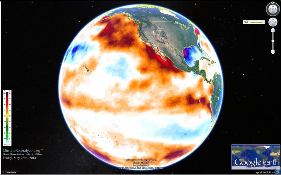
Meanhwile, sea ice extent has stopped growing, as illustrated by the NSIDC graph below.


Data from the Cryosphere Today show that the area covered by sea ice has actually fallen over the past few days, as illustrated by the image below.

[ click on image to enlarge ]
There are several reasons why sea ice isn't growing, including high temperature anomalies in the Arctic, as illustrated by the NOAA image below, showing surface temperature anomalies of over 20 degrees Celsius on November 7, 2013.


High methane levels are contributing to temperature anomalies, by trapping additional sunlight in the atmosphere over the Arctic Ocean.

Furthermore, strong winds have hit the sea ice, as the recent post Methane, Faults and Sea Ice warned. Strong winds are pushing sea ice inward in the Kara Sea and in the Chukchi Sea, while pushing sea ice - up to 5 meters thick - out of the Arctic Ocean along the coast of Greenland, as illustrated by the Naval Research Laboratory animation below.


The Naval Research Laboratory image below shows ice speed and drift on November 9, 2013.


So, could Arctic sea ice collapse and totally disappear in September 2014? Posts at this blog have repeatedly warned about this, e.g. in this post. The image below, created by Wipneus, shows an exponential trendline pointing at zero volume sea ice in September 2016.
All data over the past two decades have fallen within the 95% confidence limits of an exponential trendline that points at imminent loss of all Arctic sea ice within years. September 2013 may have been "only" the 4th lowest on record, but such variability can be expected and may well cause sea ice to disappear completely as early as September 2014.

Strong winds can speed up such a collapse. On this point, it's good to remember what Prof. Peter Wadhams warned about in 2012:
". . apart from melting, strong winds can also influence sea ice extent, as happened in 2007 when much ice was driven across the Arctic Ocean by southerly winds (not northerly, as she stated). The fact that this occurred can only lead us to conclude that this could happen again. Natural variability offers no reason to rule out such a collapse, since natural variability works both ways, it could bring about such a collapse either earlier or later than models indicate.

In fact, the thinner the sea ice gets, the more likely an early collapse is to occur. It is accepted science that global warming will increase the intensity of extreme weather events, so more heavy winds and more intense storms can be expected to increasingly break up the remaining ice, both mechanically and by enhancing ocean heat transfer to the under-ice surface."
Guy McPherson lists 26 feedbacks that speed up warming, and many of these feedbacks occur in the Arctic, as described in the post Diagram of Doom.

Soon, calculates Prof. Peter Wadhams, the albedo loss due to decline of snow and ice in the Arctic will effectively more than double the net radiative forcing resulting from the emissions caused by all people of the world. Additional warming caused by methane releases from the Arctic seabed could be even more devastating.

Hopefully, more people will realize the urgency of the situation and realize the need for a comprehensive and effective plan of action as described here.


Minggu, 06 Oktober 2013

Algae Bloom or Clathrates

There has been some discussion lately as to whether the high levels of methane observed over the Arctic Ocean originated from algae bloom or from clathrates (i.e methane hydrates).

The image below, from Arctic.io, does indeed indicate extensive algae bloom.

[ click on image to enlarge ]
The green color indicates extensive algae bloom, especially in areas where the sea water has been very warm recently, as discussed in earlier posts such as 'Is the North Pole now ice-free?' The image below shows sea surface temperature anomalies as at September 30, 2013.

[ click on image to enlarge ]
Indeed, no surprise to see extensive algae bloom, especially close to Svalbard, where the highest anomalies were recorded. The question is, however, where the methane came from that has showed up so prominently over the Arctic Ocean recently. The animation below shows methane readings over the past week, against a recent sea ice concentration map.


[ click on image to enlarge ]


These high methane levels appear to show up over the sea ice, rather than over open water. This makes it more likely that the methane originates from deep sea clathrates. The color red indicates that the sea ice has maximum concentration, so there will be few holes in the ice where algae can grow. As the top image shows, the green color shows up in areas with open water, rather than over areas covered with ice.

The image below shows sea ice thickness for the same date as the sea ice concentration map.


Even at places where the sea ice has been very thin recently, such as on the North Pole and as discussed in the post North Hole, it is now at least some 30 cm thick, making it unlikely that algae are grow there.

In conclusion, it is likely that the methane originates from deep sea clathrates, and that is a very scary development.


Kamis, 19 September 2013

Is the North Pole now ice-free?

Is the North Pole now ice-free? It could well be that, by the time you read this, there will be no ice left at all at the North Pole. The image below, created by Sam Carana from a nowcast from the Naval Research Laboratory, run on September 17, 2013 and valid for September 18, 2013, shows open water extending all the way to a spot very close to the North Pole.


As the color indicates, sea ice thickness in this area is virtually zero (i.e. ice-free). This development of an ice-free area at the North Pole has been discussed in earlier posts such as:
  • Arctic sea ice thickness falls by 2m in 21 days in some areas (June 13, 2013)
  • Open Water In Areas Around North Pole (June 22, 2013), describing areas around the North Pole where sea ice thickness had fallen to virtually zero, i.e. open water. 
  • Open Water at North Pole (July 22, 2013), descibing a wide corridor that had developed with very thin ice between the North Pole and Siberia. The post added that surface water on top of this thin ice could extend along this corridor, all the way from the North Pole to edge of the ice, in which case the surface water effectively becomes part of open water.
  • North Hole (September 2, 2013), describing areas close to the North Pole where ice volume had fallen to virtually zero, while pointing at how devastating the impact of sea surface temperature anomalies can be. 
This sea ice thinning in areas close to the North Pole has been one of the most important developments in 2013. Yet, many people keep watching sea ice extent.

Why was Arctic sea ice not smaller in extent in 2013 than in 2012?

The comparison below shows both volume and the extent of the sea ice for the same day in 2013 (left), respectively 2012 (right). Natural variability can make Arctic sea ice slightly smaller or larger than projected. There are many factors that influence things from year to year, such as weather conditions, sea currents and temperatures of the water in the Atlantic and Pacific Oceans; some factors are discussed in more detail below.


The above comparison shows a lot more ice north of Alaska in 2013 (above left) than in 2012 (above right). The comparison below shows that salinity levels in the Beaufort Sea were lower in 2013 (below left) than in 2012 (below right).


Seawater typically has a salinity level of over 3%; it freezes at about −2°C (28°F). Where mixing occurs with fresh water runoff from melting glaciers and permafrost, the water in the Arctic Ocean can become substantially less saline. Other substances added to the water, such as sand, can also cause a freezing point drop. The freezing and melting point of fresh water (i.e. zero salinity) is 0°C (or 32°F).  Less salinity means the water will remain frozen until the temperature reaches levels closer to 0°C.

Thinning continues

Heatwave conditions in Alaska caused greater melting of the permafrost. The result was more fresh water run-off through the MacKenzie River into the Beaufort Sea. This has contributed to keep sea ice extent larger in 2013. Yet, the warm water has also contributed to further thinning of the ice, reinforcing warnings that the sea ice looks set to disappear altogether within years. 


As illustrated by the above image by Neven, from the Arctic Sea Ice blog, average Arctic sea ice thickness (crudely calculated by dividing PIOMAS (PI) volume numbers with Cryosphere Today (CT) sea ice area numbers) has been very low in 2013.

The image below shows that annual minimum volumes appear to follow an exponential trend downward to zero, firstly reached in September 2015, followed by zero ice in the surrounding months over subsequent years.

Some people have objected against using PIOMAS data for such projections, with arguments ranging from suggestions that PIOMAS data were not reliable, that natural variability could prove such projections to be wrong, to questioning whether an exponential trend was appropriate. Nonetheless, it seems that over the years arguments in favor of an exponential trend have only become stronger:
  • Further measurements such as by CryoSat have confirmed that the PIOMAS data are indeed reliable and that the sea ice decline may well be even more dramatic. 
  • Natural variability goes both ways, it can either speed up or slow down ice melt. Had there been less runoff from the MacKenzie River, the sea ice in 2013 may not have been able to refreeze after being hit by cyclones several times. Next year we may not be so lucky and sea ice could disappear altogether, due to natural variability.  
  • Thick ice along the northern coast of Greenland is indeeed more persistent because of on-shore winds that cause the ice to drift and pile-up there. This would favor a Gompertz (or Sigmoid) trend in extrapolations (see image on the right). However, the new development of an ice-free North Pole shows that the sea ice is capable of breaking up abruptly, not only from the outer edges toward Greenland, but also starting at the North Pole and even moving from there toward Greenland. Moreover, as the 30-day animation below shows, thick sea ice north of Greenland can thin very quickly, suggesting it could well disappear altogether within one season.  


Sea ice can thin rapidly, even when it is multiple meters thick 

Earlier in 2013, much warm water entered the Arctic Ocean from the mouths of rivers, as discussed in the post Arctic Ocean is turning red. As said, this resulted in lower salinity levels in the Beaufort Sea that prevented cyclones from demolishing the sea ice altogether. Nonetheless, the joint impact of cyclones and warm water does appear to have caused rapid decline of the thick ice north of Greenland and Canada, as earlier discussed in an earlier post

Furthermore, sea surface temperatures have been recorded close to Svalbard that are far higher than even in the waters closer to the Atlantic Ocean. This phenomenon is illustrated by the image below, showing sea surface temperatures (top) and sea surface temperature anomalies (underneath). 


In some of these spots, sea surface temperatures are well over 10°C (50°F). Where does this heat come from? 

These hot spots could be caused by undersea volcanic activity; this is the more dangerous as the area has seen methane bubbling up from hydrates that have become destabilized; such dangers have been discussed repeatedly, e.g. in the post Runaway Global Warming. Hot spots can also contribute to even more dramatic thinning of the sea ice, including the thickest parts. 

In conclusion, there is no reason to assume that the sea ice in the Arctic will somehow magically recover. Instead, there are many indications that exponential decline of Arctic sea ice will continue. Less salinity may have temporarily prolonged the extent of the sea ice in some areas, but as sea surface temperatures keep rising, the ever thinner ice looks set to collapse within years, with dire consequences. This calls for comprehensive and effective action, such as described at the ClimatePlan blog.  


Related posts

- Arctic sea ice thickness falls by 2m in 21 days in some areas
Arctic-news.blogspot.com/2013/06/arctic-sea-ice-thickness-falls-by-2m-in-21-days-in-some-areas.html

- Open Water In Areas Around North Pole
Arctic-news.blogspot.com/2013/06/open-water-in-areas-around-north-pole.html

- Open Water at North Pole
Arctic-news.blogspot.com/2013/07/open-water-at-north-pole.html

- North Hole
Arctic-news.blogspot.com/2013/09/north-hole.html

- CryoSat - New Dimensions on Ice
esa.int/Our_Activities/Observing_the_Earth/Living_Planet_Symposium_2013/New_dimensions_on_ice

- Arctic Ocean is turning red
Arctic-news.blogspot.com/2013/08/arctic-ocean-is-turning-red.html

- Cyclone raging on thin ice
Arctic-news.blogspot.com/2013/08/cyclone-raging-on-thin-ice.html

- Runaway Global Warming
Geo-engineering.blogspot.com/2011/04/runaway-global-warming.html

- Climate Plan
ClimatePlan.blogspot.com

Kamis, 15 Agustus 2013

Arctic Sea Ice in Free Fall

Arctic Sea Ice has declined dramatically recently. The recent image below, by the Danish Meteorological Institute, shows the decline in extent over the past few days, with extent calculated by including all areas with ice concentration higher than 30%.


As the above image shows, sea ice extent (30%+ concentration) is now lower than any other year, except 2007 and 2012. Moreover, the sharp decline looks set to continue.

Ice volume and concentration have dropped dramatically, partly as a result of the cyclone that hit the Arctic Ocean a few days ago. The eye of the cyclone is still visible almost exactly above the North Pole on the Naval Research Laboratory image below on the right, where sea ice concentration appears to form a circle.

The sea ice looks set for an all-time record low; all this thin ice looks set to disappear over the next few weeks.

The graph below, also by the Danish Meteorological Institute, calculates sea ice extent by including all areas with 15% or more ice concentration.
The above graph also shows a steep recent descent, although not as pronounced as in the graph at the top that includes spots with 30% or more ice concentration. The graph at the top better illustrates recent drops in ice concentration from, say, 40% to 20%, which can occur quite abruptly due to the impact of a cyclone. 

The Danish Meteorological Institute has meanwhile produced a more recent version of the graph based on spots with 30% or more ice concentration (added below).


The above graph shows an August 15 extent that appears to be back in line with the earlier trend. At first glance, it may appear as if the sea ice has largely recovered from the impact of three cyclones that have hit the Arctic Ocean over the past two months. 

However, these cyclones are likely to have contributed to the appearance and persistence of thin spots in the ice close to the North Pole. This phenomenon was earlier described in posts such as Thin Spots developing in Arctic Sea Ice

The conclusion remains the same as the one drawn then in that post, i.e. that for years, observation-based projections have been warning about Arctic sea ice collapse within years, with dire consequences for the Arctic and for the world at large.

Cyclones can speed up this collapse. On this point, it's good to remember what Prof. Peter Wadhams said in 2012:
". . apart from melting, strong winds can also influence sea ice extent, as happened in 2007 when much ice was driven across the Arctic Ocean by southerly winds (not northerly, as she stated). The fact that this occurred can only lead us to conclude that this could happen again. Natural variability offers no reason to rule out such a collapse, since natural variability works both ways, it could bring about such a collapse either earlier or later than models indicate.

In fact, the thinner the sea ice gets, the more likely an early collapse is to occur. It is accepted science that global warming will increase the intensity of extreme weather events, so more heavy winds and more intense storms can be expected to increasingly break up the remaining ice, both mechanically and by enhancing ocean heat transfer to the under-ice surface."
Hopefully, more people will realize the urgency of the situation and realize the need for a comprehensive and effective plan of action as described here.

Senin, 12 Agustus 2013

Cyclone raging on Thin Ice

Another cyclone is raging over the Arctic Ocean. The Naval Research Laboratory image below shows the speed and drift of the sea ice.

[ click on image to enlarge ]
Last time a cyclone hit the Arctic, this resulted in a temporary increase in area covered by sea ice, as shown on the Cryosphere Today image below. The cyclone pushed down on the sea ice, flattening it and pushing it sideways. 


Note that area as measured by the Cryosphere Today includes all spots that have a 15% or higher concentration of ice. This way of measuring area ignores the fact that the cyclone reduced the sea ice concentration in many spots, from a high sea ice concentration (around 90%) to a lower concentration (less than 80%), as shown on the Naval Research Laboratory image below. 


Furthermore, sea ice has since dropped in thickness, as illustrated by the Naval Research Laboratory image below. 

Much of the ice is now less than one meter thick, while some areas close to the North Pole have ice that is only between zero and half a meter thick.

The cyclone is raging most fiercely in those areas and much of the ice is drifting out into the Atlantic Ocean.

Neven mentioned at the Arctic Sea Ice Blog that average thickness (crudely calculated by dividing PIOMAS (PI) volume numbers with Cryosphere Today (CT) sea ice area numbers, see image below) had a very steep drop in July, similar to the drop in 2010. This year's trend line is now lowest, probably signifying that the ice pack is spread out and thin at the edges (read: melting potential).

[ click on image to enlarge ]
The image below, from the University of Bremen, Germany, shows sea ice concentration on August 11, 2013.